


Hurricane Maria! Screaming at Washington After Killing 3000+ on Puerto Rico.
- Samuel Cussins Allen, Jr.

- Aug 7
- 6 min read
Updated: Aug 27

WHEN THE GOVERNMENT TELLS YOU THAT HURRICANES CAN’T BE STEERED, THEY ARE LYING TO THE MASSES!
This image is Hurricane Maria steered into Washington DC after killing more than 3000 people on the island of Puerto Rico. This came after Hurricane Irma, which was also steered across Puerto Rico. Were the Mormons trying to get rid of Trump? Was Trump’s response to Puerto Rico after Irma an embarrassment? Is Donald Trump the moronic puppet being steered by the Mormon Church hierarchy? Was Trump and the Mormons financially backing Jeffrey Epstein, his pedophile island and is this why Trump and the Mormons are attempting to have his criminal records expunged? Amazing how these people keep dying by suicide, huh? https://people.com/virginia-giuffre-jeffrey-epstein-prince-andrew-abuse-accuser-dies-by-suicide-at-age-41-11706343
.

In order to understand Trump’s ties to the Mormons, and Stanford University Consortium buying Trump Enterprises (Donald and his Father) out of Bankruptcy, you need to understand the Mormon ties to Leland Stanford, whose son Leland Stanford, Jr. the university was named after as noted in this article:
This excerpt from the article reflects how Brigham Young, the head polygamist and Leland Stanford became associates and controlled much of the wealth in America, as well as the collection of gold now being pursued by Russia’s Putin.


Below is a link to the actual satellite video from which the headline image was extrapolated and provided by MyRadar

If your ever wonder where Jeffrey Epstein was getting his financial backing and why no hurricanes ever hit his pedophile island, but were steered to Puerto Rico, here’s your clue. Trump’s ties to polygamy, pedophilia were hidden during his first term.
This is how your government allows Trump and the Mormons to use radar and cellular microwaves to generate severe weather conditions across the United States and steer hurricanes like Dorian to make anearly 90 degree turn to avoid Miami and Mar-A-Lago.


Here are two attempts by the Later Day Saints trying to get control of this image. Informed them that I don’t own it because it is a satellite produced image from MyRadar.


Starting with the west coast of North America, here is radar and cellular emissions that contribute to their wildfires and soil erosion, these super power radar sites controlled by the Mormons in Utah, Nevada, Idaho, Montana, Florida, Puerto Rico, Guantanamo Bay and other U.S. locations that control the weather.
Here’s the link to the satellite video of the super powerful radar at Battle Mountain, Nevada that covers the Western states, along individual state radar and cellular microwave systems that contribute to wildfires, electrical storms, tornadoes, heavy rainfall and snowfall, soil liquefaction with coastal collapse and regional flooding.
The “Texas Freeze” and power shutdown was directly connected with this radar site in Cedar City, Utah and please note the high power emissions that couldn’t be hidden from the satellite.

Actual video:
Here are the radar sites in Idaho and Montana.

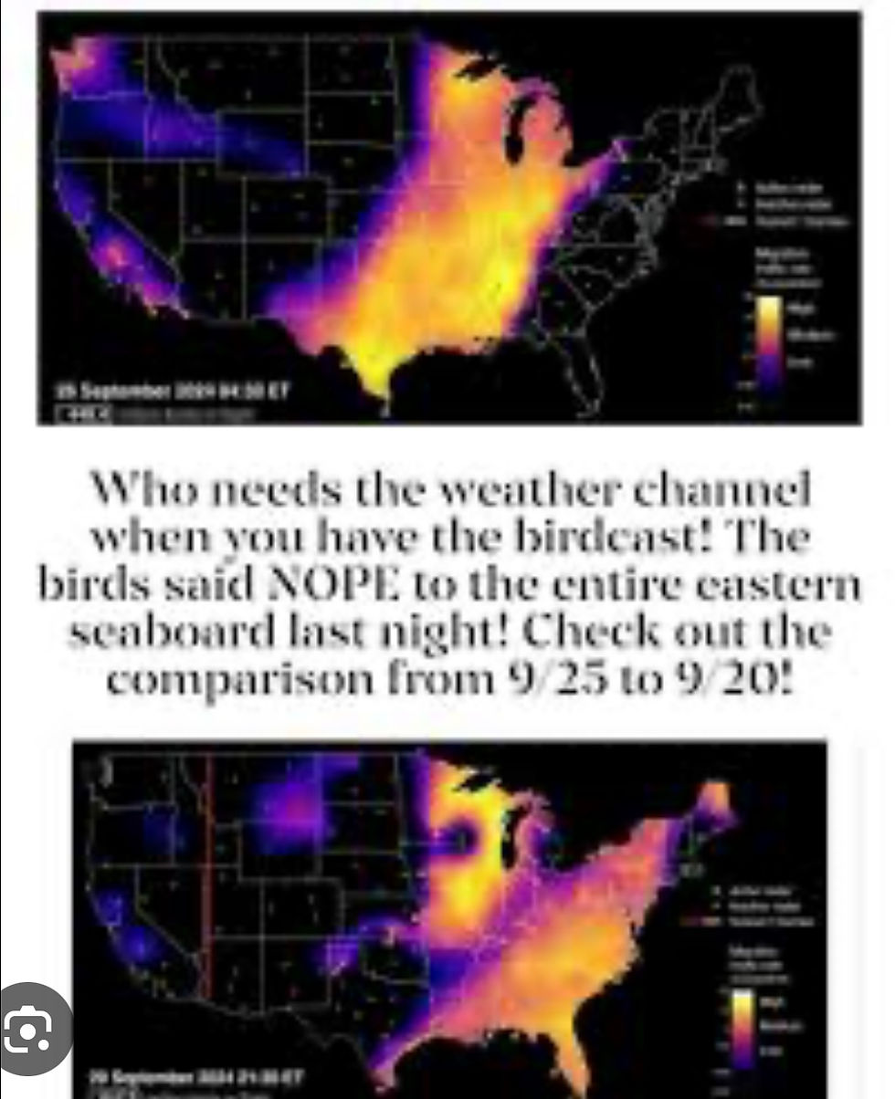
The meteorological society worldwide and domestically lie to the public and call these radar and cellular microwave emissions “bird cast” like shown below.


The super power radar sites like these also reside in Idaho, Wyoming, Montana, Nevada, California, Florida, Guantanamo Bay Cuba, Puerto Rico and other eastern sites like New Jersey that attracted Hurricane Sandy into New Jersey where their casinos were failing.
How the Mormons Destroyed Joplin, Missouri. What the government failed to explain to the people of Joplin.
The following satellite photos we extrapolated from the ten years of satellite videos at this link: https://youtu.be/VCdb9_VhIvU These satellite images show the progression of radar generated storms that destroyed Joplin, Missouri between May 21 to May 26, 2011 and
killed 161 and injured 1000 people.


On 22 May 2011 the radar generated storms aligned and moved eastward with a line from Canada to Texas, with tornadoes possible. Utah and Montana were generating more radar storms to follow.


This link actually show the radar and cellular microwave emissions that atttacted Hurricanes Florence and Helene to the Carolinas. If they continue to use the radar and cellular microwaves on any 2025 hurricanes, they will again attract hurricanes, tropical storms, produce tornadoes and severe flooding with soil liquefaction as occurred with Helene. https://photos.app.goo.gl/PfhWyWP6rdX74raj6

Here’s a photo of Trump and the Mormons directing the steering of Hurricane Dorian to miss their high rise condos in Miami and their Mar-a-Largo country club. The results of Trump and the Mormons use of high intensity radar microwaves forced Dorian to make a 90 degree turn, avoiding Florida altogether, as the Image below shows.

If anyone ever states that hurricanes can’t be steered, here’s a contradiction that exhibited extreme lightning discharges from the radar microwave superheating of the water molecules that forced Dorian to make the 90 degree turn. Here’s more evidence of hurricanes being steered
This is how Trump steered both Hurricane Irma and Maria across Puerto Rico using their Doppler radar system, that Maria destroyed, allowing Maria to proceed up the east coast to Washington DC. This website article warned Puerto Rico well in advance of Hurricane Ernesto, of what was coming based on the fact that Irma and Maria were steered to their island using the attraction of the radar system installed on their island. No response!
This also might have saved Joplin, Missouri had they known what was coming and where it was being generated:

How about steering hurricanes to achieve voter suppression! Hurricanes Helene and Milton are great examples right before the 2024 election of Trump.


Here’s a picture article that displays the radar domes they couldn’t hide from the satellite, that diverted Hurricane Milton to Tampa Bay, planned well before Milton left the Yucatan Peninsula. How did Florida know to evacuate Tampa Bay before Milton left the Yucatan Peninsula?
And if your still not convinced that Puerto Rico’s hurricanes weren’t steered to their island by radar and cellular microwaves, this website article published in August 2024, shows the warnings and progress of Hurricane Earnesto after development in the Atlantic and Puerto Rico’s use of radar microwaves to steer it to their island ignoring warnings provided from Hurricanes Irma and Maria. Puerto Rico officials turned a blind eye to these warnings, possibly because they were being paid to ignore them. https://machinbird.wixsite.com/samcusstheory-1/post/puerto-rico-warned


Comments